
Nature
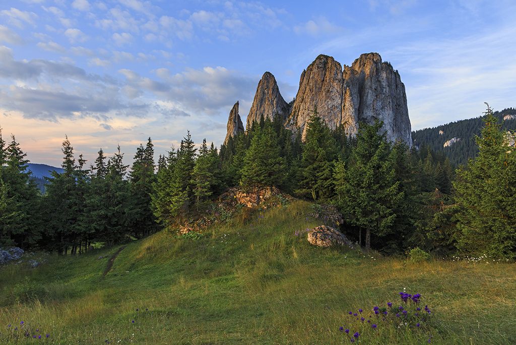
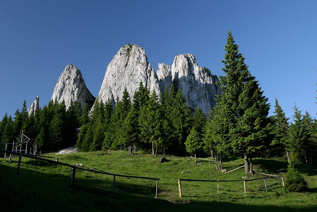
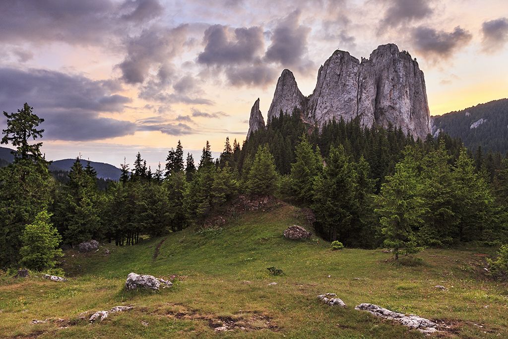
The mountain ranges of the Eastern Carpathians hold several hidden treasures of Székely Land for their visitors. Some are more widely known, such as the Békás (Bicaz) Gorge, the Gyilkos (Roșu) or Szent-Anna (Sfânta Ana) lakes, while some other natural wonders, such as several interesting rock formations from the Jurassic era of Hagymás (Hăşmaş) Mountains, still remain less known. One of their interesting and fascinating formations is the Egyes-kő (best translated from Hungarian to English as “solitary rock”). The Nagy-Hagymás (Hășmașul Mare), the Egyes-kő and the Öcsém-tető (Vf. Ecem) which seem to protect the Csíki (Ciuc) Basin, luring the tourist to visit them.
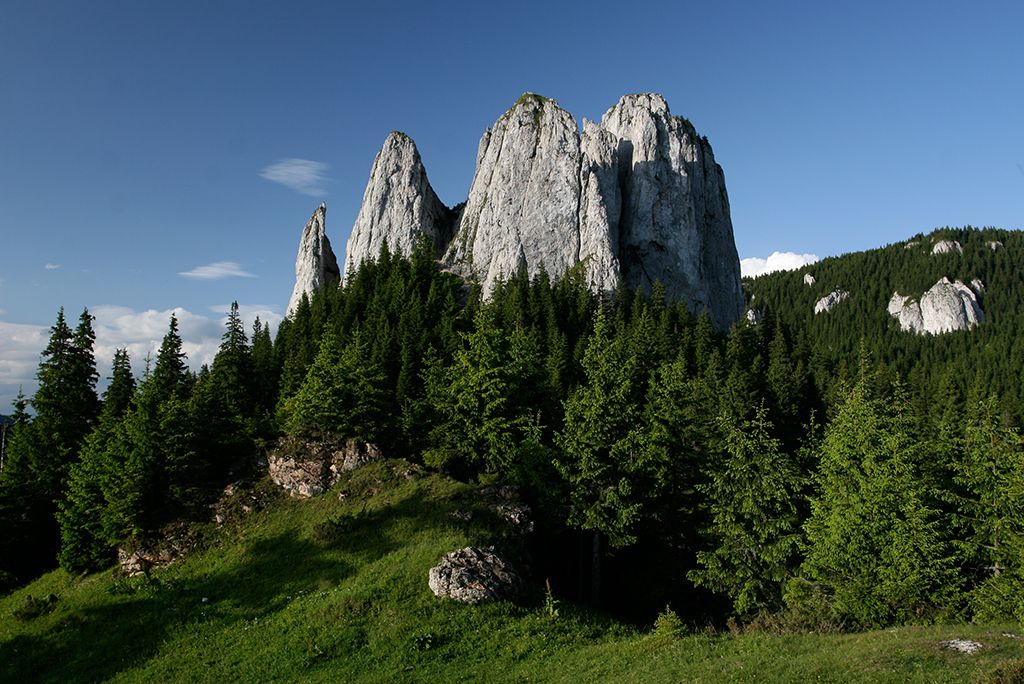
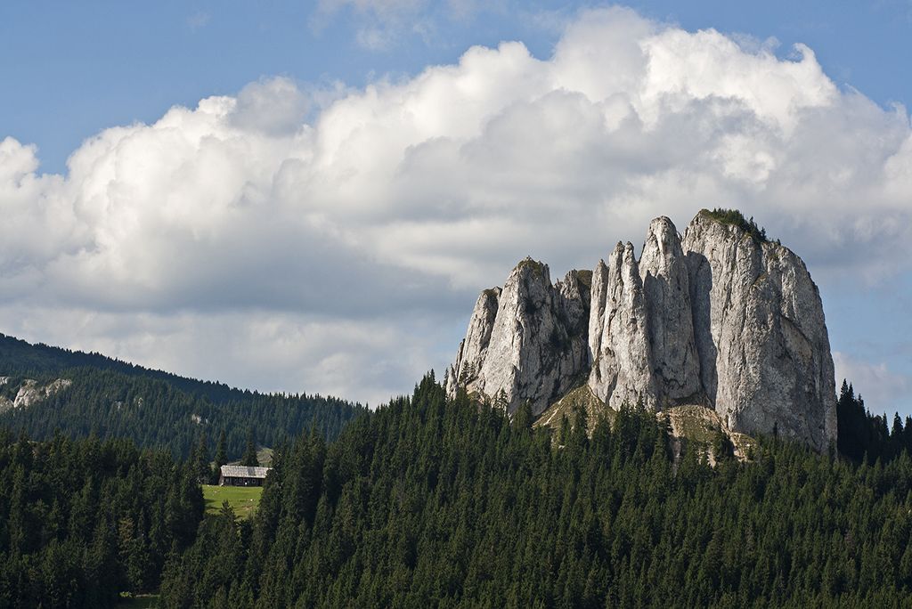
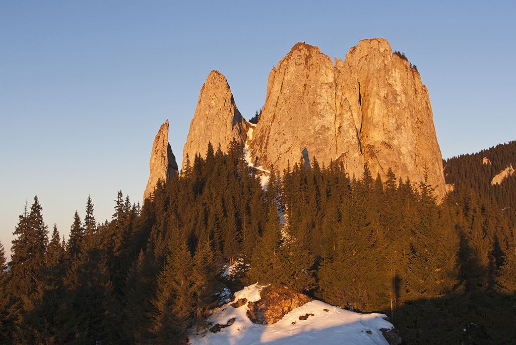
The Hagymás (Hășmaș) Mountains are often called the Alps of Csík. Seen from the Csíki-hollow, one will encounter of the left the Nagy-Hagymás (Hășmașul Mare), which, with its 1792 m, is the highest peak of the Hagymás (Hășmaș) Mountains. In the middle, at a height of 1608 m, the Egyes-kő shows off all its four cliffs proudly, whereas on the right, at 1706 m height, the Öcsém-tető (Vf. Ecem) and its long rocky walls frame the hollow.
The Nagy-Hagymás (Hășmașul Mare), the Egyes-kő and the Öcsém-tető (Vf. Ecem) are all part of the Békás Gorges - Hagymás Mountains National Park, founded in 1990, in order to conserve and protect the flora and fauna of this territory. The National Park has varied and unique geologic and geomorphologic elements, its microclimatic conditions determined by the exposure of slopes, enables the existence of rich and diverse flora and fauna. The area of the park, of 6575 ha is divided into two zones: the special conservation zone (78%), and the protection zone (22%).
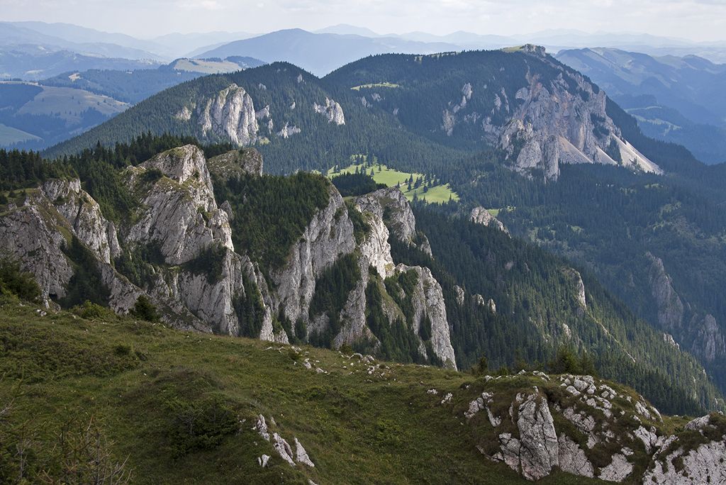
The Hagymás Mountains are limestone and sandstone massifs located in the central part of the Eastern Carpathian Mountain Range bordered by part of the Gyergyói (Giurgeu) Mountains, and on the East the Cretaceous Flysch sequence The foundations of the Hagymás Mountains were formed more than 4 billion years ago from Mesozoic limestones and dolomites covering the soft rocks from the Precambrian era, which make for the characteristic scenery of the mountains.
The Nagy-Hagymás (Hășmașul Mare), the Egyes-kő and the Öcsém-tető (Vf. Ecem) were formed out of sedimentary rocks on which, due to various crust movement in different geological periods, other types of rocks were deposited. The main rocks, formed out of schist, sank several times during the Paleozoic and the tank-like hollow was flooded by the sea formed in the Triassic period. In this same period the already existing rocks got covered mostly by dolomitic, dolomitic-calcareous and other sedimentary rocks in the deeps. In time, erosion left its fingerprint on the newly formed rocks: these whitish, aphanitic rocks are the base of what the Nagy-Hagymás-Öcsém cliff wall is today.
During the Jurassic period further stratification modified the already existing rocks, finally, in the late Jurassic the surface got covered again and sank under a warm shallow sea, which turned out to be optimal for the formation of coral reefs. The cliffs of the Nagy-Hagymás, Egyes-kő, Öcsém is 400-500 m thick whitish coral-limestone wall, accumulated during the “underwater” period.
The easiest way of getting to Egyeskő is from Balánbánya (Bălan). Approaching by car is easier; in that case you will leave the main European road E578 at Csíkszentdomokos (Sândominic in Romanian) and continue the journey on the 125 county-road towards Bălan/Balánbánya. The nearest train stop is at Csíkszentdomokos village (the name of the station is Izvoru Oltului). From there you must continue further by bus, hitch-hike or walk (the distance is about 11 km).
There are two hiking trails leading up to Egyeskő from Balánbánya. One starts in the town centre, at the Roman Catholic Church and follows the valley of Kovács (Fierarului) creek (marked with blue stripe). In the Kovács-patak street you will find a small parking lot. From here, continue the journey on foot, following the trail signs.
The other starts from the town's northern end and keeps the hikers/tourists along the valley of Szép (Sep) creek (marked with red triangle). Egyeskő can be approached on the main ridge of Hagymás Mountains (Munţii Hăşmaş) starting from either Gyimes (Ghimeş), or the popular Békás Gorge (Cheile Bicazului). The ridge is marked by a hiking trail from both directions. This kind of approach requires more time and energy, but it offers a much wilder outdoor experience in change.
On the southwestern part of Egyes-kő there is a hikers’ hut, situated on 1504 m, which was reconstructed in 2010. The shelter is on the crossroad of many hiking trails, being an important tourist attraction. The ground and upper floor have two heated rooms, where the hikers can rest, have their meals or just relax.
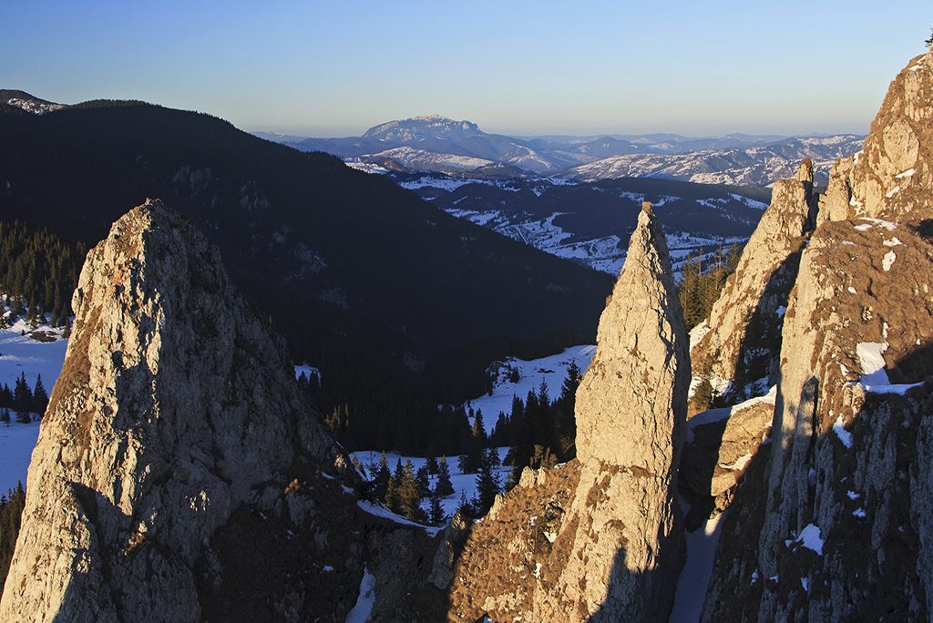
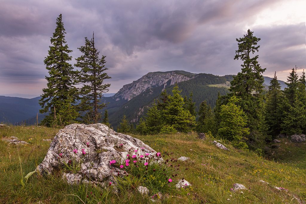
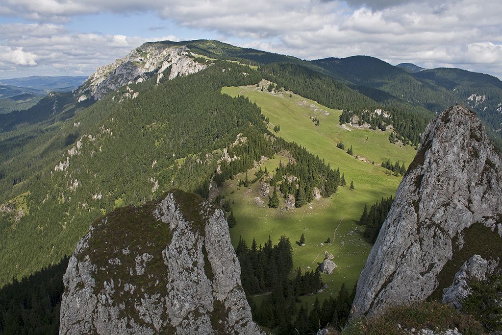
In the immediate vicinity of the shelter the cliff walls of Egyes-kő can be approached easily. The wall can be climbed or, with the proper equipment, the highline path can also be used. Yes, physical condition is a must! Be aware of your limits and capabilities. Reaching the top, at a height of 1608 m, the sight will take your breath away, the spectacular view of the Csíki Basin and the surrounding pine trees will charm you for sure.
Tourists visiting Egyes-kő will return home with thousands of new experiences, not only because of the picturesque landscape, but every trail and path will uncover the secrets of the Mountain: beautiful flowers, some endemic to this area. During the dawn hikes the tourists can “meet” the chamoises, the mountain birds and the foggy mountain sky.
But if you climb the cliff just to relax, it is more than enough: the fresh air and the sights, the conversations with other hikers, climbers and tourists will make your day.